I have a very bad sense of direction. In fact it is beyond bad sense. I get so bemused that I keep going round and round the destination most of the times where I need to reach. My friends find it hard to believe that I can be so bad! It’s sort of dyslexia with directions? There are many people like me who are lost in finding directions while driving or walking. To top it, in each city and village there is such a lot of work going on – tr affic diversion for the Metro rail construction, flyover bridges, road maintenance, drainage maintenance, new bridge construction………something or the other keeps the traffic going at snail’s pace each day and the some or the other road is kept closed. Another fact is travelers are lost in finding routes because the transport system consists of routes planned in isolation rather than as parts of coordinated networks. Poor route planning results in poor route coverage. Hope someday the scene will change. If something can save you when you are lost in travel, it is the GPS! Most of the times it gives you the correct directions, rarely even GPS makes mistakes.
Global Positions System (GPS) was launched in the United States in 1973. While creating this system the project overcame limitations of previous navigation systems, by incorporating ideas from several predecessors, including a number of classified engineering design studies from the 1960s. The U.S Department of Defense developed the system, which originally used 24 satellites. It was initially developed for use by the United States military and became fully operational in 1995. It was allowed for civilian use in the 1980s. Roger L. Easton, of Naval Research Laboratory, Ivan A. Getting of the Aerospace Corporation and Bradford Parkinson of Applied Physics Laboratory are credited for inventing GPS. The design of GPS is based on ground-based radio-navigation system.
The GPS does not require the user to transmit any data, and it operates independently of any telephonic or internet reception. GPS provides critical positioning capabilities to military, civil, and commercial users around the world. The United States government created the system, maintains it, and makes it freely accessible to anyone with a GPS receiver. But, there is one truth: the US government can selectively deny access to the system, as happened to the Indian military in 1999 during the Kargil War. USA was aware that the Indian Subcontinent had the greatest risk of being involved in a nuclear war. They behaved “snooty” and denied help to both warring parties i.e India and Pakistan because they wanted to take a stand by attempting to bring both parties at the negotiating table. They believed that access to GPS or any technology for that matter would be interpreted as a help to India which would perhaps prolong the War. Their indifference at that moment led India to develop its own Satellite Program called GAGAN which is India’s indigenous GPS. Necessity is mother of invention ….India turned that impediment into an opportunity!
The Indian Space Research Organization (ISRO) and Airports Authority of India (AAI) have executed the GPS Aided Geo Augmented Navigation-GAGAN project as a Satellite Based Augmentation System (SBAS) for the Indian Airspace. The objective of GAGAN is to establish, install and certify satellite based augmentation system for safe civil aviation applications in India.
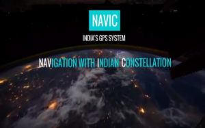
From next year onwards if you lose your way in any part of the country or anywhere in the Arabian Sea, ‘NavIC’ will come to your rescue and help you find your way. India’s very own desi Global Positioning System (GPS) is operational and is all set to hit the market for public use in 2018. The Indian Regional Navigation Satellite System (IRNSS) with an operational name of NavIC is currently being tested for its accuracy. For many years now, India had been dependent on GPS of U.S. Besides America’s GPS, Russia has its GLONASS and European Union has its Galileo. China is also in the process of building BeiDou Navigation Satellite System.
I simply love this ad Vodafone. After the Airtel 4G girl became one of the most popular face in social media and advertisement world, telecom giant, Vodafone brought the coolest granny and grandpa on board as their brand ambassadors for the Vodafone 4G campaign. The couple in their 70s is Bharatnatyam Dancers Shanta Dhananjayan and V.P Dhananjayan from Chennai who have both been honored with the Padma Bhushan award. They appear in several ads of Vodafone: chilling in Goa on their second honeymoon after 35-years of marriage, getting a tattoo to parasailing, catching up with their granddaughter on Facebook at the railway station etc. The endearing duo is not just adventurous but is also shown to be keeping pace with technology using GPS on 4G Vodafone network, using Facebook live, Google maps, video calling and photo-sharing features. This ad has become so popular, which shows age cannot bog you down.
GPS is really a boon to many people who are poor with directions, who can’t find way in new cities. Besides this, the advancement in GPS tracking technology has been nothing short of marvel. It helps in tracking teen drivers, single vehicles, fleet of vehicles, or even our luggage while travelling. The best part of this most exciting technology is – it can track victims of Alzheimer’s disease and dementia. Kudos to its inventors!!!


